Once again some of our members will be up the hill to compete in the Practical Wireless 144MHz QRP Contest.
We will use the callsign GM4YEQ/P and be operating from our usual spot on the Yarrow Swire/Witchie Knowe IO85MM.
The contest runs from 0900-1500UTC (1000-1600 BST).
Members and visitors are welcome to come along and join in or assist, or just see what we do. Bring your own food/drink and suitable footwear for a grassy field. The rough road is suitable for vehicles to drive up to the site but there are deep puddles. Keep dogs under control as there is usually livestock in the field.
We’ll mostly be tuning around or calling CQ on the SSB part of the band (144.150-144.397MHz) but will scan around the FM simplex part of the band for any local callers with handhelds (calling CQ on 145.500MHz in the contest is not allowed).
Exchange is signal report and serial number starting at 001 for the first contact, and 6-character Maidenhead Locator (or approximate location if not known).
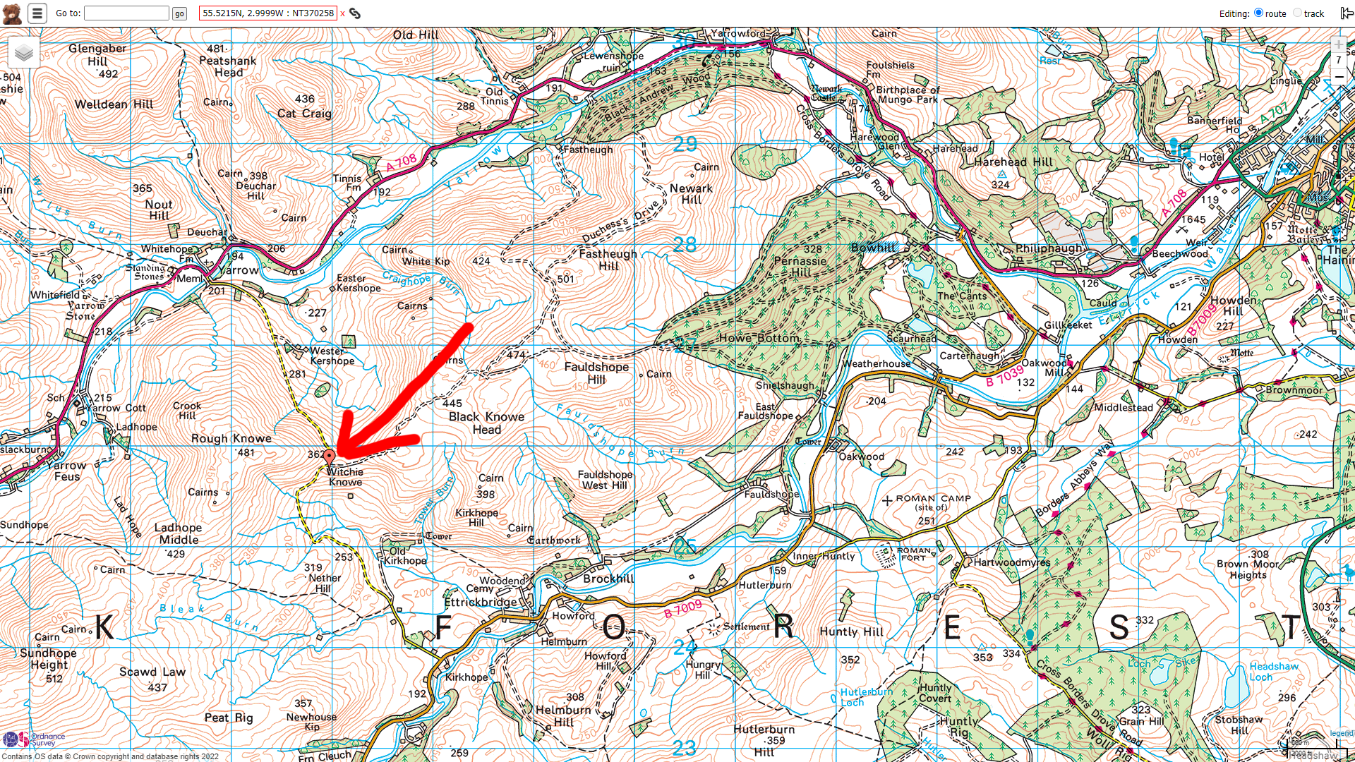
Location: Yarrow Swire, off summit of C22 road between A708 (Yarrow) and B7009 (Ettrickbridge). Marked as Witchie Knowe on some maps.
Locator: IO85MM
Coordinates: 55.5215N , 2.9984W 360m (1180ft) ASL
NGR: NT370257 (WAB Square NT32) (NT 37058 25768)
Google Maps shortcut: 9C7VG2C2+JJJ
Closest Postcodes: TD7 5ND (Wester Kershope Farm on north side of the hill on the approach from Yarrow valley) or TD7 5JW (Area covering from our site southwards)
What3Words: /// juggles.police.chiefs (Switch to satellite view)
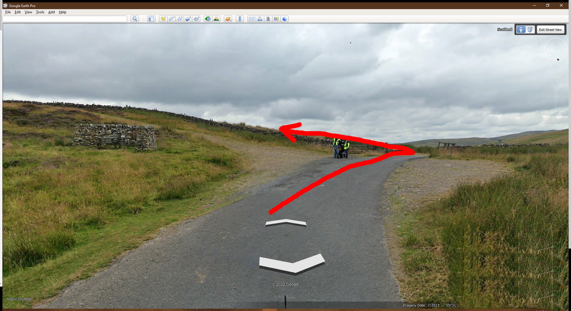
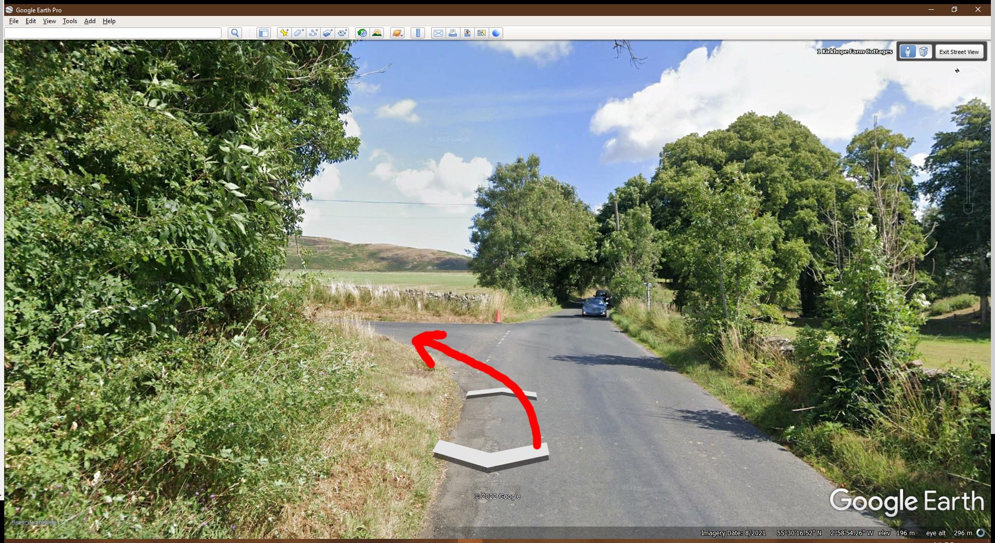
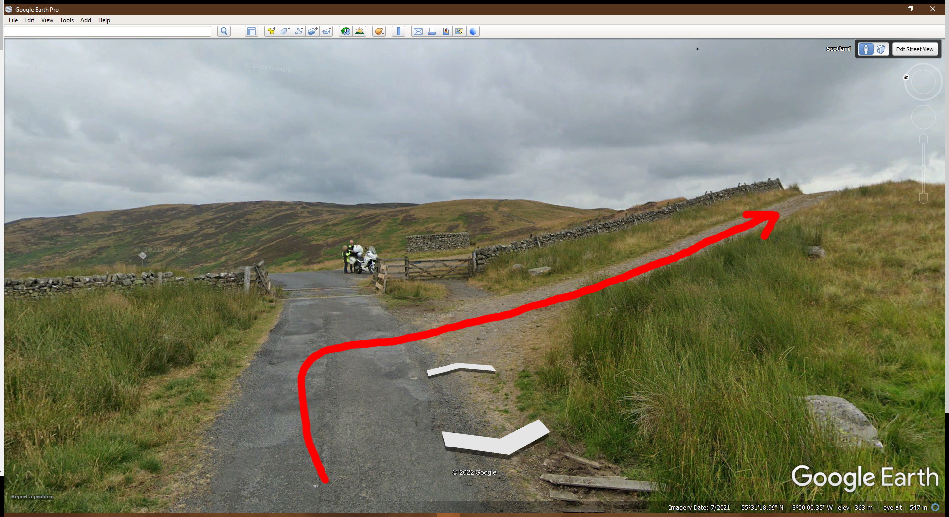
Directions:
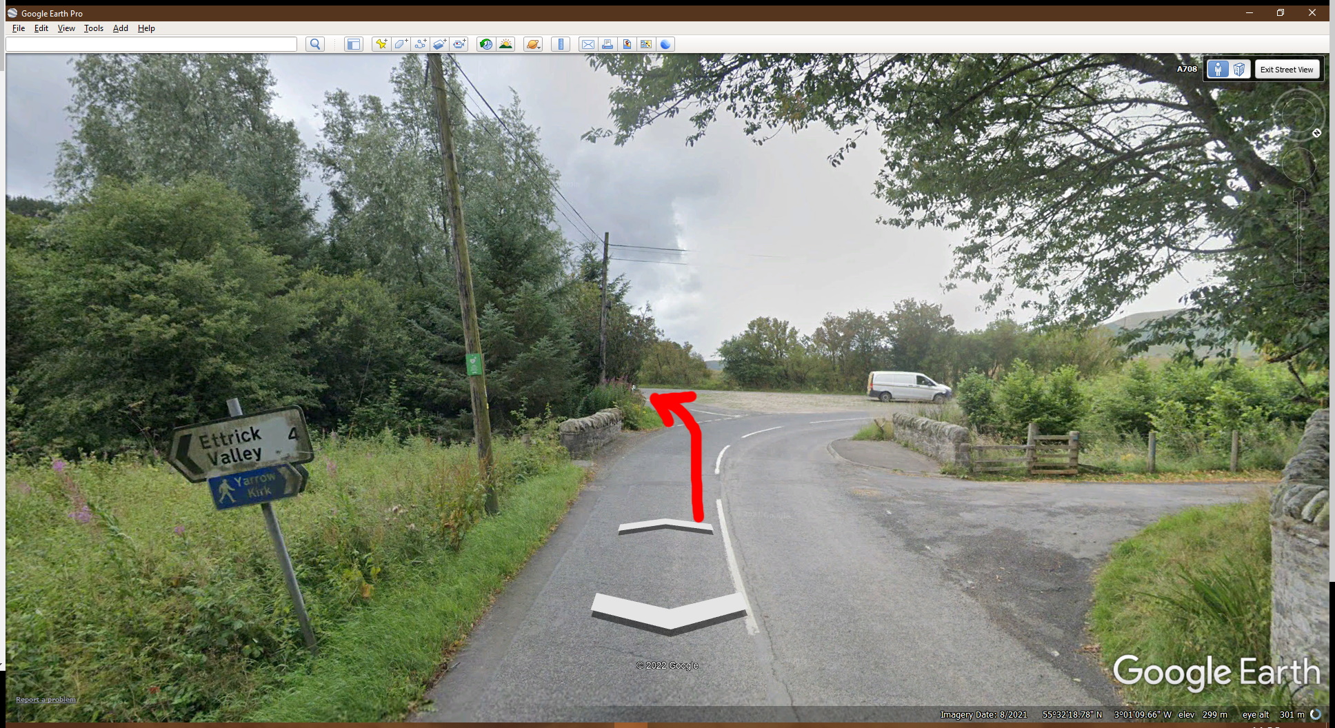
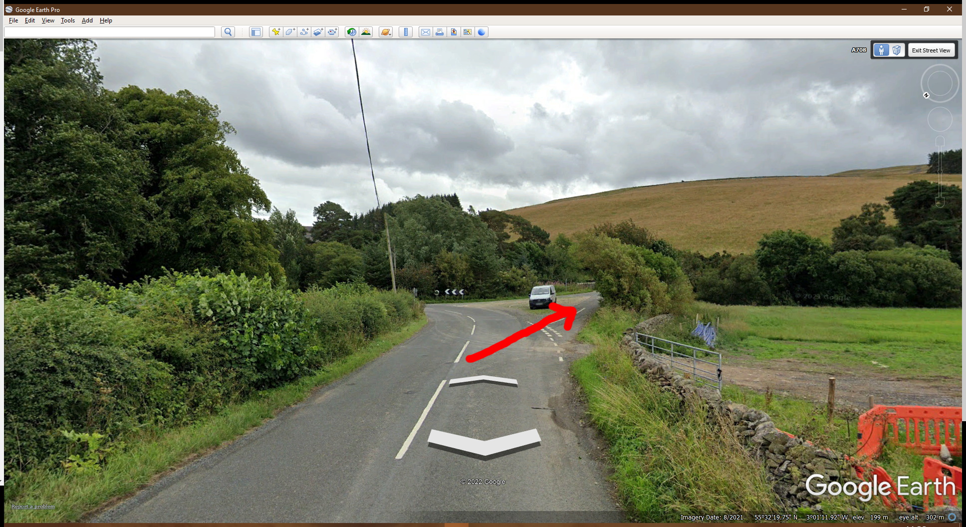
From Yarrow Valley:
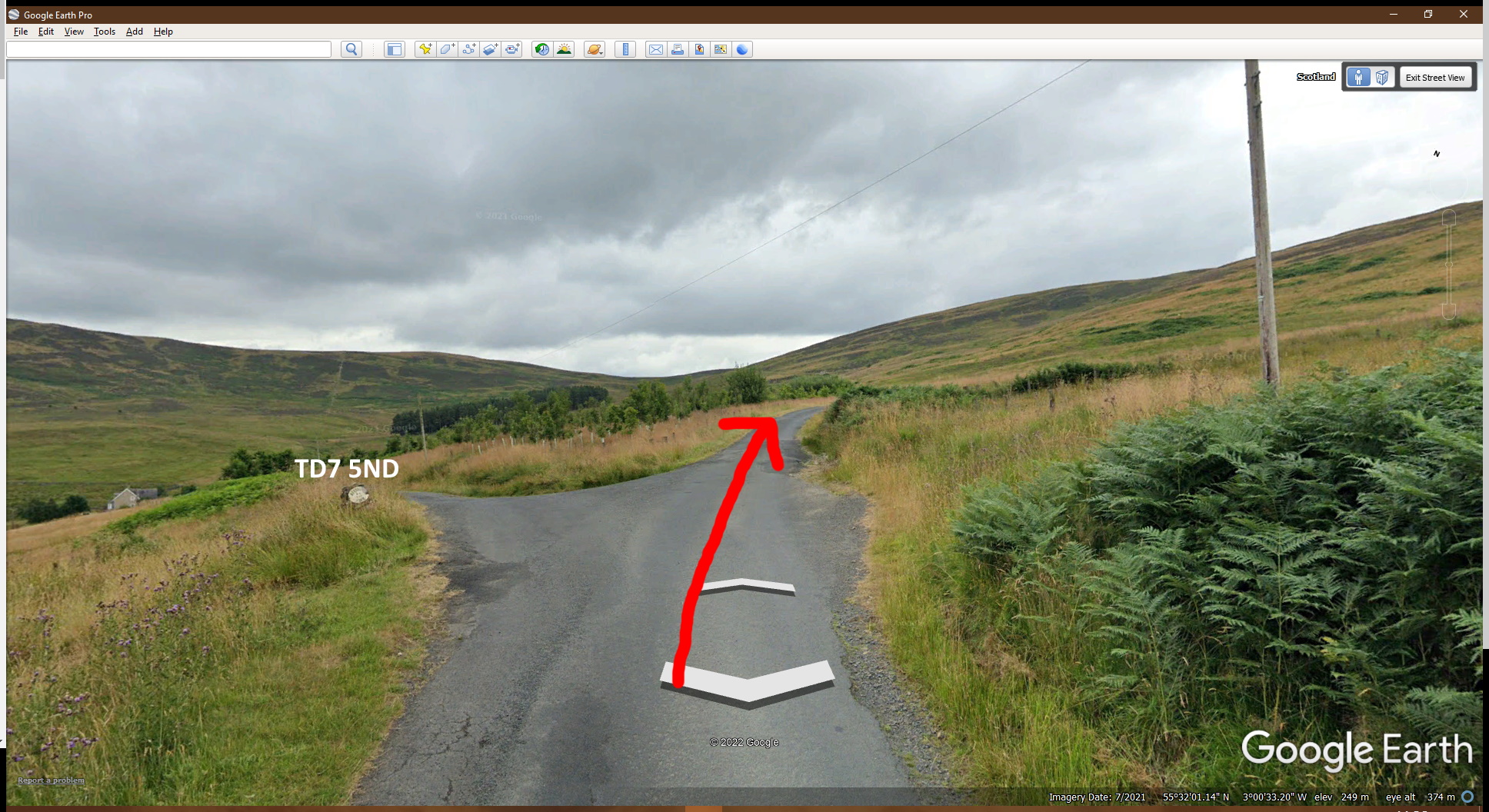
From Ettrick Valley

0 Comments.